
Problem: Wildlife biologists working in Great Smoky Mountains National Park are seeking to define areas of black bear (Ursus americanus) habitat within the park where human interactions are unlikely to occur (Fig. 1).
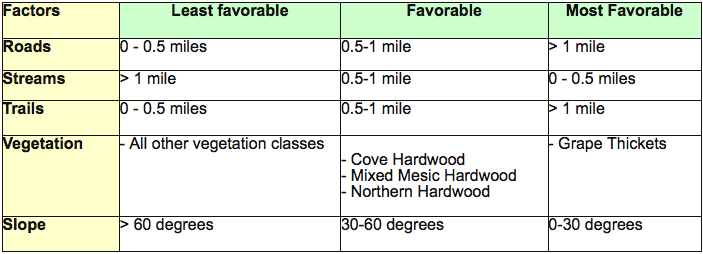
Figure 1. Suitability parameters given for bear habitat unlikely to be disturbed by humans.
Analysis Procedures: Suitability analysis or site selection can be performed via GIS analysis and determines the best locations for something dependent on applied criteria. Weighted suitability analysis allows one to answer questions or solve problems that are impacted by many factors and assign varying weights to each of the factors. The result gives more information than binary analysis, as it ranks locations based on the suitability rather than giving only a suitable/not suitable result.
The first steps to using a weighted overlay for suitability analysis are to define the problem and break it down into smaller, manageable submodels. Next, one must determine what layers are necessary to solve the problem and reclassify/transform these layers, so that they use the same scale and can be easily combined. These layers may be vector (e.g. line, polygon, point) or raster data. For this problem, stream, trail, and road data were line vectors, vegetation was a polygon vector, and elevation was a raster dataset. Transformations may include changing vector data to raster data, calculating distances to features, and/or determining slope, aspect, etc. The last step, before performing the weighted overlay, is to reclassify each layer. This gives the layers a common scale (i.e. 1 to 5, 1 to 9, etc.) that will be preserved in the final overlay. Finally, the weight of each layer is assigned, the layers are combined in a weighted overlay, and the results are analyzed. See Fig. 2 for a graphical depiction of the model used to solve the bear exercise. A procedure log for this exercise is available here.
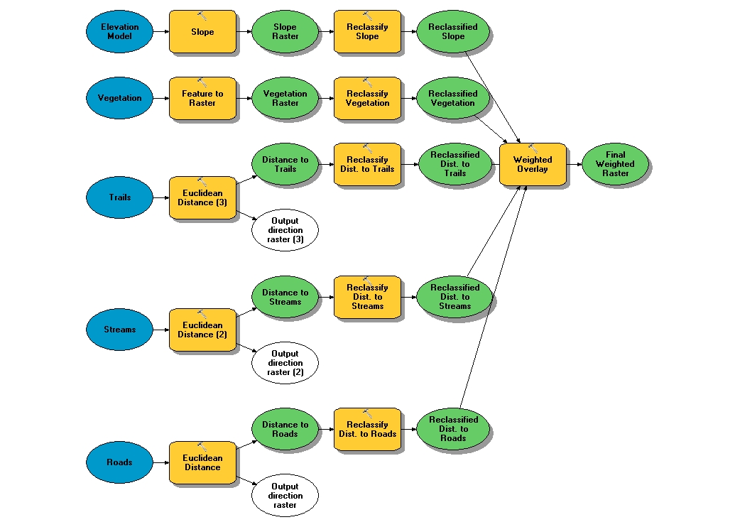
Figure 2. Model builder diagram for transforming and reclassifying layers to perform a weighted overlay to determine areas of suitable bear habitat unlikely to be disturbed by humans. Click on diagram for enlarged image.
Results:
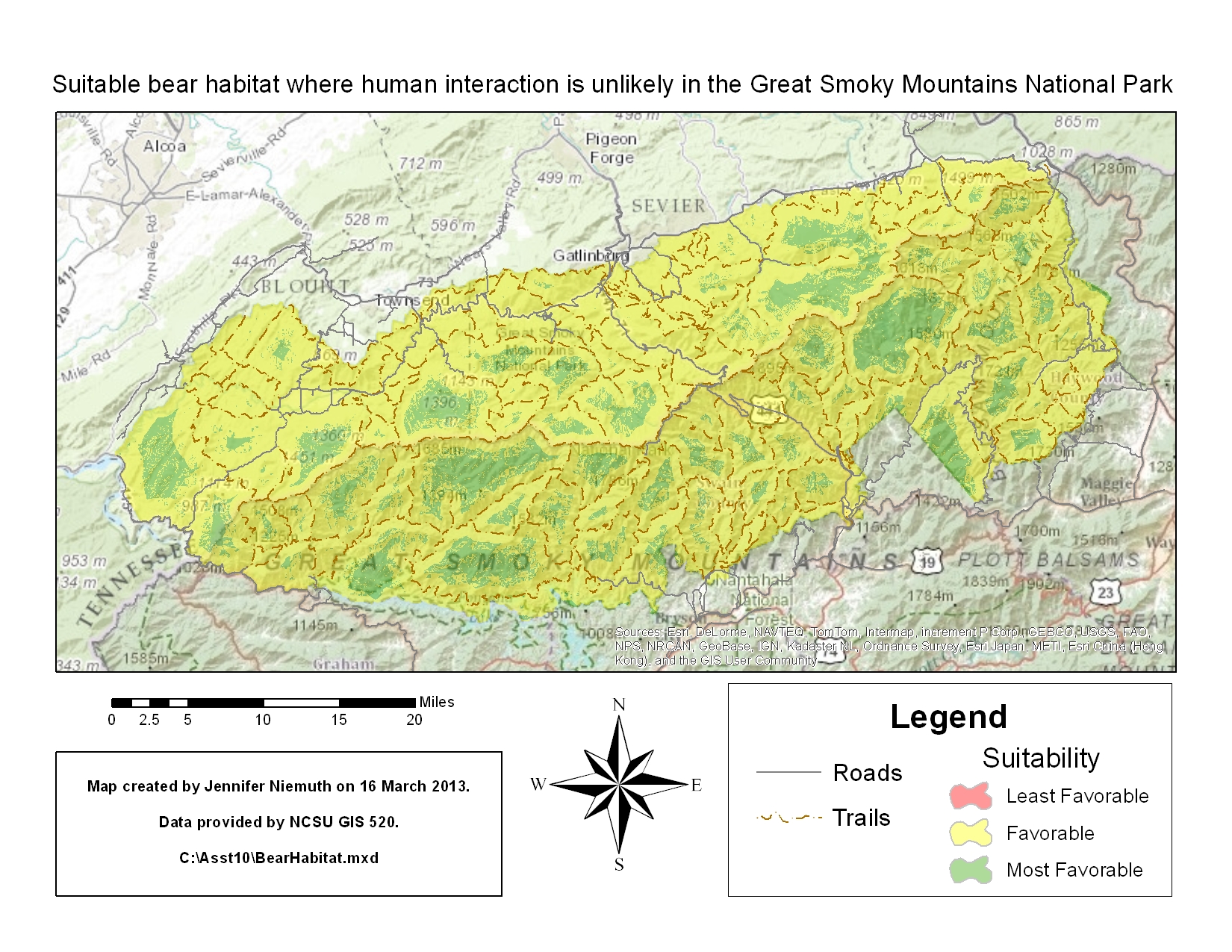
Figure 3. Suitable areas of bear habitat with Great Smoky Mountains National Park that are unlikely to be disturbed by humans. Click on map for enlarged image.
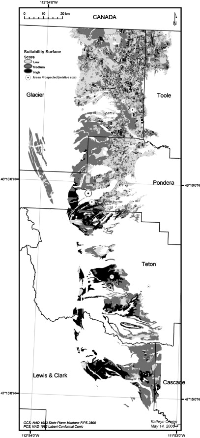
Figure 4. Suitability surface map indicating likelihood of fossils in the Two Medicine Formation, Montana, USA. Click on map for enlarged image.
Application and Reflection: The skills and concepts learned in this exercise could be applied to a multitude of similar problems within the field of conservation biology. Beyond determining habitat suitability, this type of analysis could also be used to determine best locations for blinds/hides, site campsites to minimize wildlife disturbance, or locate possible areas of interest for a survey. GIS and suitability analysis can be used in numerous fields and applications, from finding a site for a new landfill to predicting where dinosaur fossils are likely to be found.
GIS and suitability analysis has been used successfully to predict sites where fossils will be found. This effectively decreases the amount of time and money spent searching for fossil sites. For example, the model used by Oheim (2007) explained 90% of fossil density variation in the Two Medicine Formation in Montana (Fig. 4).