
Problem: Create two custom toolbars, including a custom drop-down menu and a button for an add-in, add a tool to the layer context menu, and populate an attribute table using the add-in functionality.
Analysis Procedures: Not all of the available tools in ArcMap are found within toolbars and some tools that may be frequently used together are found in separate toolbars. Customizing or creating new ArcMap toolbars can increase efficiency and productivity, as well as make ArcMap easier for a non-GIS professional to use. Additional tools, available for download, add functionality to ArcMap.
Once the need for customization of the ArcMap interface has been identified, one must determine what method of customization will be most useful (Fig. 1). Tool buttons can be added to active menus in the ArcMap interface, tools can be added to context menus, and new custom toolbars can be created. The first two options involve simply dragging new tools from the customize mode menu to their new location (after opening the context menu to be customized in the case of adding tools to a context menu). New toolbars are created within the same menu and tools are also added by dragging them to their location within the new toolbar. Tools within a customized toolbar can also be organized in a custom drop-down menu. After adding a “New Menu” to the custom toolbar, new tools can be dragged to the custom drop-down. Finally, add-in functions (from the internet, colleagues, etc.) can be downloaded, installed, and added as buttons to toolbars from the customize mode window within the “Add-in Controls” category. A procedure log for this exercise is available here.
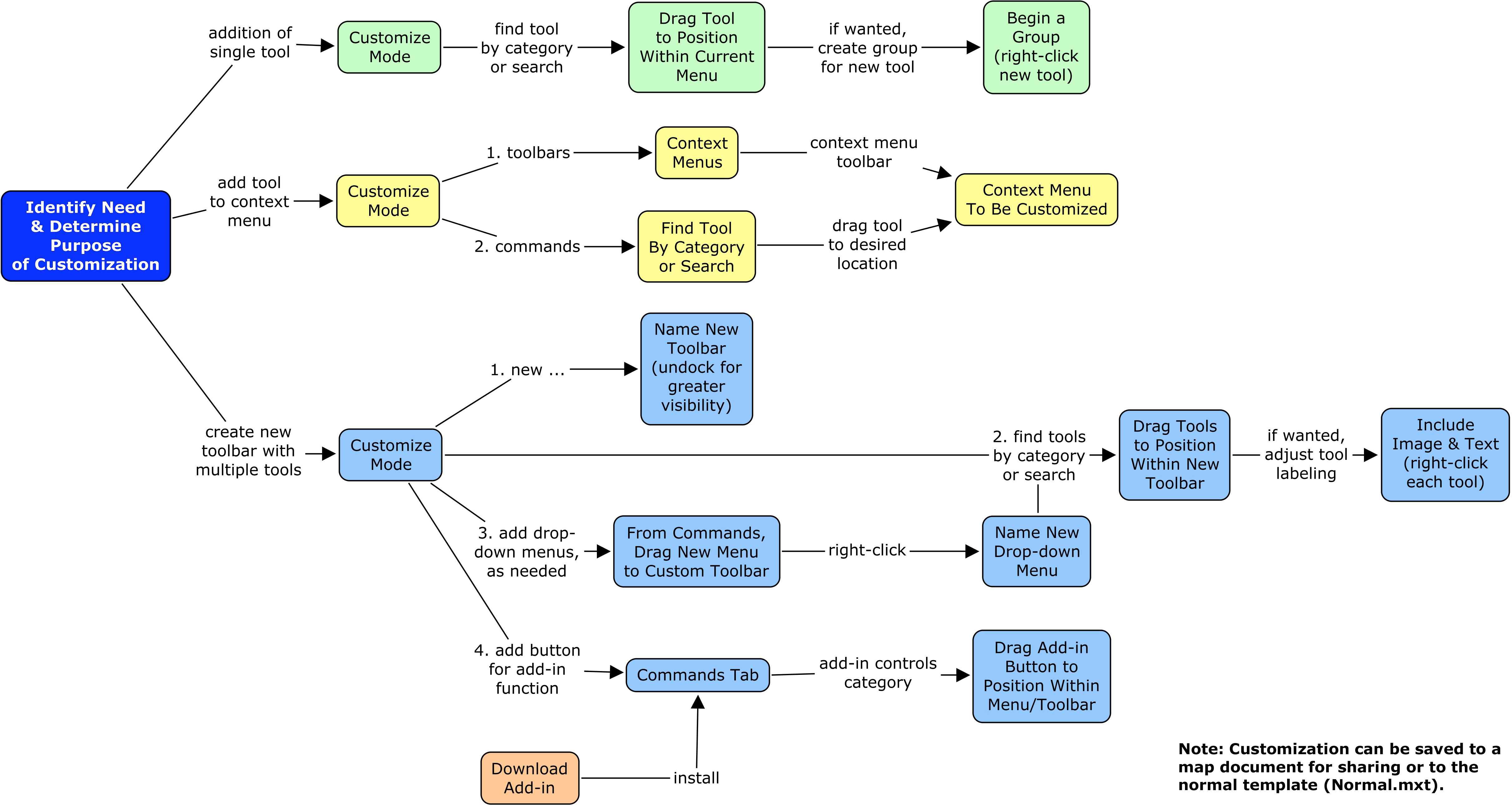
Figure 1. Workflow diagram for multiple ways of customizing the ArcMap interface. Click on the diagram for an enlarged image.
Results:
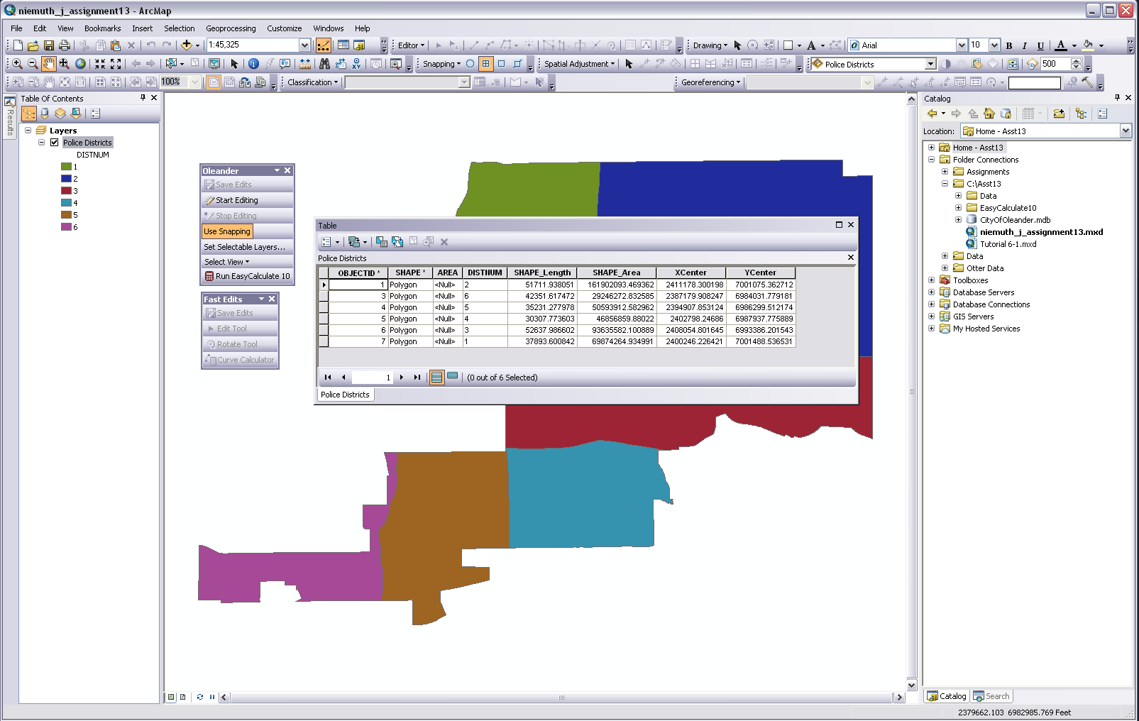
Figure 2. Screenshot showing two new custom toolbars, which include a custom drop-down menu and a button for a downloaded add-in function. The attribute table shows X and Y centroid values that were populated using the add-in. Click on the figure for an enlarged image.
Application and Reflection: The skills and concepts from this exercise can be utilized in any field, but especially where non-GIS professionals may need to use ArcMap or where tasks are very repetitive. Customizing menus, toolbars, and keyboard shortcuts can increase efficiency and make ArcMap easier to use. Downloaded add-in tools give ArcMap functions not possible with the stock installation.

Figure 3. Screenshot of the WSDM ArcMap data entry add-in (Blatz & Duff). Click on figure for enlarged image.
Natural resource agencies often collect occurrence data for threatened and endangered species. This information may come from professionals or the public. To make data entry easier, the Wildlife Survey Data Management (WSDM) team for the Washington Department of Fish and Wildlife (WDFW) developed an add-in (Fig. 3). The add-in simplifies data entry and ensures data consistency.