
Problem: Develop a file geodatabase for the NC State University campus containing specified featured classes using data from a CAD file that is not georeferenced.
Analysis Procedures: Georeferencing a CAD file to a reference file with known coordinates, such as an aerial orthophoto, gives CAD data a spatial reference, which makes it more useful for solving GIS problems. Layers of interest in the georeferenced CAD file can also be exported to feature classes in a file geodatabase for easy organization and distribution (Fig. 1). Specific feature classes to be included in the final file geodatabase were located in both the CAD polygon and polyline layers. These layers were campus buildings, streets, sidewalks, streams/creeks, lakes/ponds, and athletic fields. The projected coordinate system was set to match the reference file and then the CAD data was scaled and shifted to roughly match the aerial orthophoto and georeferenced by selecting 2 control points on opposite extents of the map. Some of the polygons for buildings in the CAD file were displayed as polylines because their polygons were not closed. By exporting the building features to a shapefile, the features could be converted to polygons, and the resulting feature class imported to the file geodatabase. Each remaining feature class of interest was selected and exported individually to the file geodatabase. A procedure log for this exercise is available here.
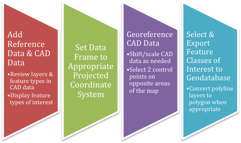
Figure 1. General workflow diagram for georeferencing and exporting CAD data to a file geodatabase in ArcMap.
Results:
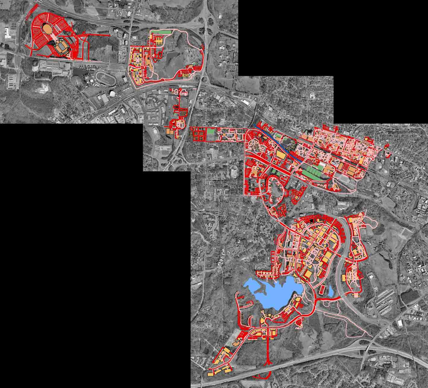
Figure 2. CAD data of the NCSU campus after georeferencing to the reference aerial orthophoto (color scheme for visibility). Note that the CAD features are aligned with the features in the photo.
Application and Reflection: Frequently, many scientific disciplines must work together in order to solve a problem. Wildlife biologists and veterinarians often work with foresters, developers, law enforcement officials, government agencies, non-profit organizations, and others to manage wildlife. Given the prevalence and complementary nature of CAD and GIS, it would not be unexpected for these groups to utilize data from both systems. It is also important to understand the limitations and pitfalls of each; for example, so one knows to look for possibly polygons that have not been completely closed before moving on to analysis steps. Being proficient at moving between systems and creating organized data that is easy to distribute is fundamental.
An example of how these systems can work together is found in Austin et al. 2005 where wildlife habitat associated with roads is examined in Vermont. Various GIS data was utilized (e.g. land cover, core habitat, etc.) along with CAD data from the state police on wildlife collisions to create a map comparing wildlife crossing ratings and habitat suitability (Fig. 3). The data needed to solve complex research problems is likely to come from diverse sources and in a variety of formats. Georeferencing CAD data and distributing features of interest to a file geodatabase is one example of how non-GIS data can be converted to be useful for GIS analyses.
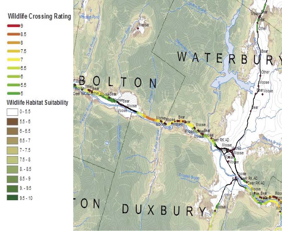
Figure 3. Final map from Austin et al. 2005 showing habitat suitability, wildlife-linkage habitat values, and road-mortality data in Vermont.