
Problem: The coordinators of a local art showcase have tabular address data, but would like to visualize spatially where their attendees come from, so they can better direct future marketing efforts.
Analysis Procedures: Given attendees’ information and reference information, ArcMap can geocode the attendees addresses to spatial locations on a map (Fig. 1), thus giving the coordinators an easier way to visualize where their attendees are coming from and where they might want to market in the future. The showcase coordinators provided a table of their attendees’ address information while street, county boundary, and zip code information was available through the Wake County government website. After reviewing the metadata and attribute tables to ensure the appropriateness of the data, address locators were setup in ArcMap. Depending on how the data were to be geocoded (e.g. to zip code, street, etc.), the correct address locator style and reference data was selected. After activating the address locator, the attendees’ data could be batch geocoded by providing the address locator with the respective address field(s) in the tabular data. The resulting matches, ties, and unmatched records were reviewed and corrections made. Examples of corrections made were missing zip codes, incorrect zip codes, and inappropriate street abbreviations. Professional map layouts were then created to display the final results. A procedure log for this exercise is available here.

Figure 1. General workflow diagram for geocoding addresses in ArcMap.
Results:
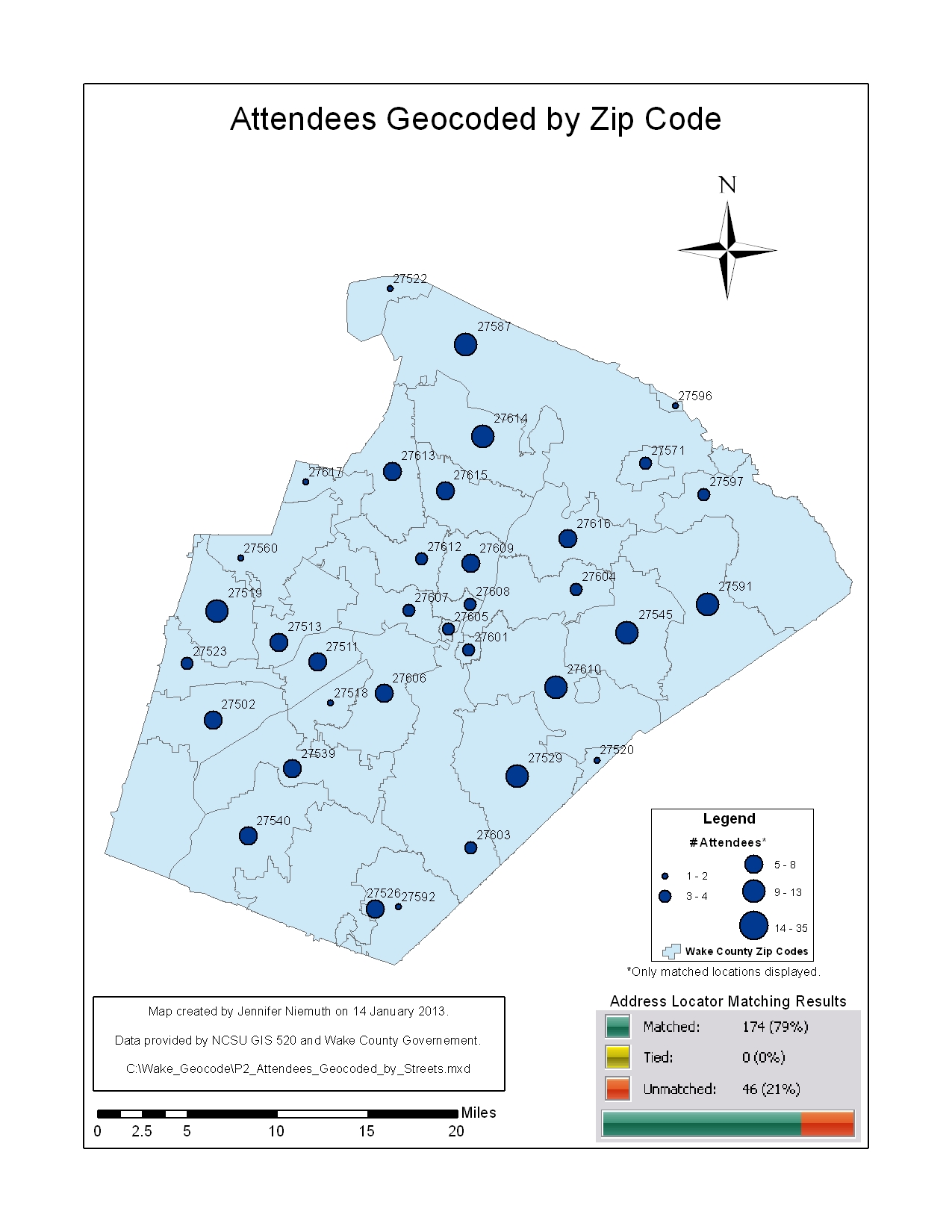
Figure 2. Showcase attendees geocoded by zip code. The main drawback of this method is that multiple attendees in the same zip code cannot be differentiated spatially. The showcase coordinators would not be able to visualize where attendees were coming from within the zip code areas.
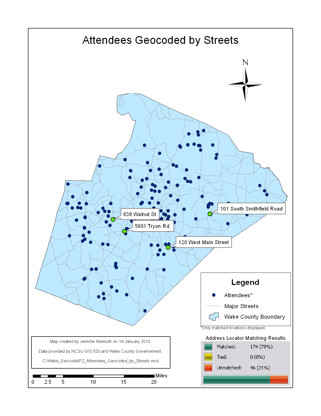
Figure 3. Showcase attendees geocoded by street. As this method allows attendees to be identified uniquely by house number, the showcase coordinators will be able to better visualize what areas of the county their attendees are coming from.
Application & Reflection:The skills and concepts learned in this assignment could be applied to solve any number of similar problems. Geocoding permanent address information for past veterinary students could help prioritize which undergraduate programs recruiters may visit. Geocoding school district information for field trip groups visiting a zoo could be used to help direct mobile zoo workshops. Finally, location data is often collected during wildlife research. This tabular data could also be geocoded to help the researcher visualize where diseased animals are concentrated (Fig. 4), where wildlife-vehicle interactions are frequent, or where endangered species have been sighted just to name a few possibilities. Geocoding tabular data may provide a final answer and spatial picture for a problem or may be just the start of the geospatial analysis process.

Figure 4. A real-world example of the usefulness of geocoding. A veterinary diagnostic laboratory geocoded address information for dogs positive for coccidiomycosis in Texas to determine potential risk areas for human infection. Image from Gautam et al. 2012.