
Problem: Determine if road ratings are associated with the number of accidents using linear referencing.
Analysis Procedures: Linear referencing allows information about a geographic location to be stored in reference to a position (i.e. measurement) on a linear feature . This permits data to be collected and used for variables that change along a linear feature. There are a number of ways to use linear referencing to answer a study question (Fig. 1). In general, a linear feature and tabular data that describes various conditions or aspects of the linear feature are required. For example, starting and ending mile markers for a section of road may be listed with various attributes specific to that section of road. The tabular data can be combined with the linear feature to create a new layer that spatially represents the tabular data. Multiple tables of data for the linear feature can be combined to answer more complex questions and display more complicated spatial relationships. Linear referencing utilizes dynamic segmentation to simplify geographic data storage by allowing multiple variables to be stored for a single segment/position of a linear feature. A procedure log for this exercise is available here.
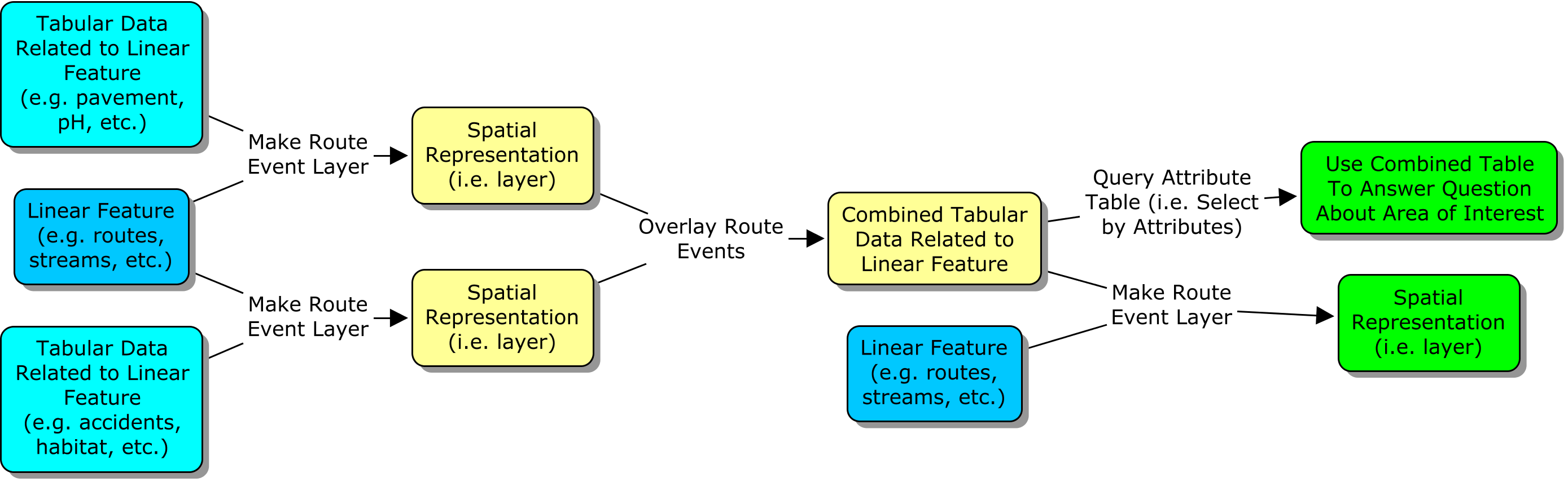
Figure 1. General workflow diagram for utilizing linear referencing to answer a study question. Blue boxes are input data (tabular and linear), yellow boxes are intermediate steps, and green boxes represent the final output. Click on the diagram for an enlarged image.
Results:
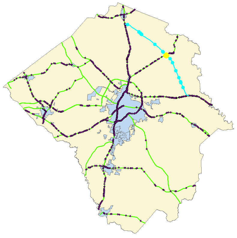
Figure 2. Representation of Pitt County, PA showing city boundaries (blue polygons) and routes (green lines) with accident locations (purple diamonds). Accidents on the route of interest have been selected (shown in aqua) with an accident at mile 7.23 highlighted (yellow dot).
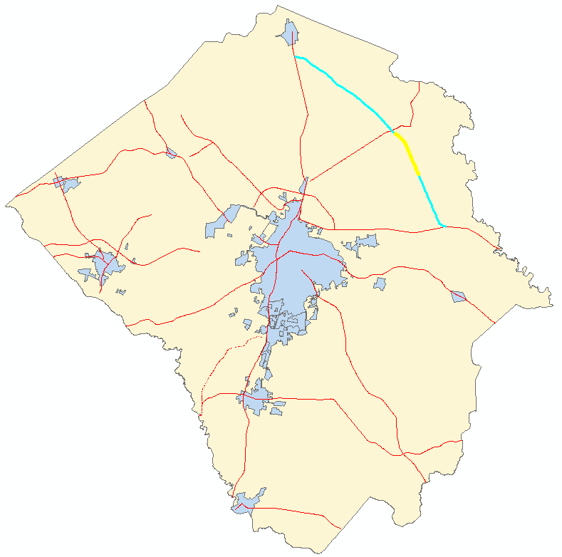
Figure 3. Representation of Pitt County, PA showing city boundaries (blue polygons) and route pavement layer (red line). The route of interest has been selected (aqua line) with the segment encompassing miles 4 through 7 highlighted (yellow).
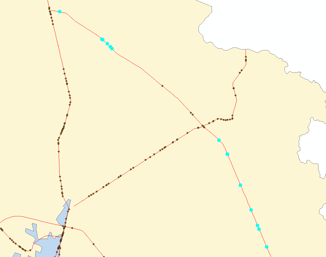
Figure 4. Representation of a section of Pitt County, PA zoomed on the route of interest after merging the accident (purple diamonds) and pavement data (red lines). The selected accidents (aqua dots) are accidents on the route of interest where the pavement rating was less than or equal to 75 (out of 100). There was no apparent correlation between number of accidents and condition of the road (i.e. pavement rating) with 1.7 accidents/mile where the rating was less than or equal to 75 and 1.6 accidents/mile where the rating was greater than 75.
Application and Reflection: The skills and concepts taught in this exercise are useful not only for showing how complex questions involving a number of variables can be answered using GIS, but also how to simplify data management. Linear referencing is utilized in the planning and management of highways, public transportation, railways, utilities, etc. It can also be used effectively in the biological sciences.
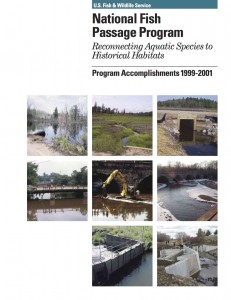
Figure 5. Fish distribution and habitat data can be used for programs that help improve fish passage, such as the National Fish Passage Program.
Linear referencing can be used to manage data from waterways, such as pH, dissolved oxygen, turbidity, and wildlife habitat suitability. Road and highway data may also include data about wildlife, such as locations of wildlife crossings or mortalities depicted in an article mentioned in a previous exercise.
Management of fish and their habitats is commonly accomplished with the help of GIS data that uses linear referencing. State and federal departments collect and publish data using the linear referencing model. The Oregon Department of Fish and Wildlife provides habitat distribution data for a number of species. This type of data can be used to identify areas where fish passage programs (Fig. 5) should concentrate their efforts removing dams, renovating culverts, and installing fish screens and ladders.